K5 UFO (K58plus)
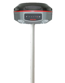

DGPS (Base+Rover+controller+Radio) 440 Channel
Single: $3950
One Set:$8940
692 channels, dual battery hot-swappable, fusion of good price and good performance

692 Channels,
B3 Supported.
With the latest developed 692 channels BEIDOU GNSS board inside, K5UFO maximizes the utility of BEIDOU (COMPASS) signal, the data acquisition speed and GNSS signal stability are greatly improved.
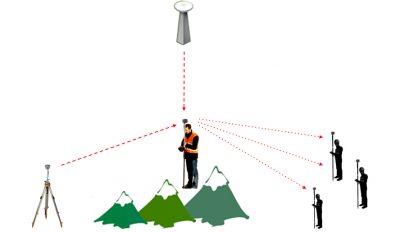
Barrier-Free
Measurement
In difficult environment you may lost connection with base station or VRS network. Don’t be disappointed, you can choose from 3 creative work modes to continue surveying without interruption. (Repeater/ Router/ Mobile Refenrence Station)
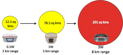
Long Range
Radio Link
SDL400 built-in radio can send signal as far as 7 km in urban area, 8 km in suburban. The maximum coverage is up to 200 sq.km, suitable to have multiple rovers work simultaneously.

Anti-interference
SDL400 built-in radio features anti-interference capability, so K5UFO can work close to power plant, transformer substation, mobile signal tower and other interference source.

The Best in Town
To improve the performance in city survey, R&D team upgraded the network module from 3G to 4G.
Under 4G mobile network, data transmission is faster and more stable. SUPER RTK is still compatible with 3G and 2G.
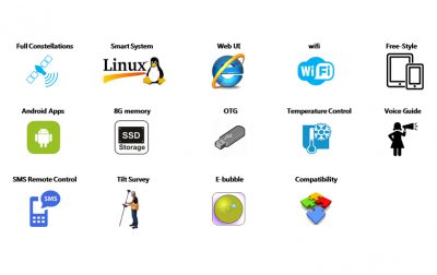
Practical Functions
See what others can’t. K5UFO employs Linux system, it helps surveyors to accomplish their missions easier, faster and more accurate by delivering exceptional quality and innovative features.
(The Tilt Survey function is optional, not included in default configuration)
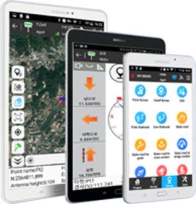
New app. New Productivity
Windows CE data controller is too old technology?
No problem. Simply download SurvX App on your smart phone or tablet.
Enjoy the smooth operation of Android platform !
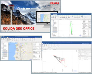
Post-processing Sw. Free of Charge
KOLIDA GEO Office integrates
static data processing & Kinematic data adjustment
| Satellite Tracking Ability | ||
| Channels
692 |
Constellation
GPS, GLONASS, BEIDOU, GALILEO, SBAS, QZSS |
MSS L-Band
Function preserved |
| Positioning Output
Rate1Hz-50Hz |
Initialization Time
<10s |
|
| Positioning Precision | ||
| UHF RTK
Horizontal ±8mm + 1 ppm Vertical ±15mm + 1ppm |
Network RTK
Horizontal ±8mm + 0.5ppm Vertical ±15mm+0.5ppm |
RTX
Horizontal ±2cm Vertical ±5cm |
| Static and Fast Static
Horizontal ±2.5mm + 0.5ppm Vertical ±5mm + 0.5ppm |
RTK Initialization Time
2-8s |
|
| User Interaction | ||
| Operation System
Linux |
Web UI
Yes |
Wifi
Yes |
| Voice Guide
Yes |
Data Storage
8GB internal; up to 32GB external. |
|
| Working Capability | ||
| Radio
Built-in emitting and receiving Typical working range 1-8km |
Tilt Survey
N/A (Optional) |
Electronic Bubble
Yes |
| Endurance
>14 hours (static mode), >10 hours (internal UHF base mode), >12 hours (rover mode) |
OTG Function (Field Download)
yes |
Other Function
Mobile Reference Station, Repeater, Router, CSD |
© 2015 - 2025 Geoapplied Co.Ltd. All rights reserved.
Powered by Insight Web Studio